The soil evaporation data of sub-alpine grasslands in Tianlaochi Catchment in Qilian Mountain (2013)

This data is soil evapotranspiration data of subalpine grassland in tianlaochi small watershed of Qilian Mountain.
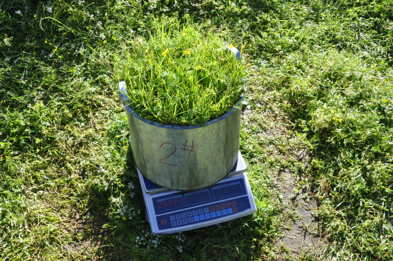
Lysimeter was used to observe soil evapotranspiration and provide basic data for the development of watershed evapotranspiration model. Six repeated experiments were conducted to observe the soil evapotranspiration of subalpine grassland during the whole growing season. At 8:00 and 20:00 every day, use an electronic scale with an accuracy of 1G to weigh the inner barrel. In case of rainfall, observe whether there is leakage in the leakage barrel. If there is leakage, measure the leakage water in the leakage barrel at the same time. Observation instrument: 1) standard 20 cm diameter rain gauge. 2) Lysimeter was made by ourselves (diameter 30.5cm, barrel height 28.5). 3) Electronic balance (accuracy 1g) is used to observe the weight change of lysimeter.
Copyright & License
Excel format storage
Data Citations
Cite as:Ma, W., Zhao, C. (2014). < b>The soil evaporation data of sub-alpine grasslands in Tianlaochi Catchment in Qilian Mountain (2013)</b>2014. doi: 10.3972/heihe.045.2014.db. (Download the reference: RIS | Bibtex )
Using this data, the data citation is required to be referenced and the related literatures are suggested to be cited.
Terms of Use
To respect the intellectual property rights, protect the rights of data authors, expand services of the data center, and evaluate the application potential of data, data users should clearly indicate the source of the data and the author of the data in the research results generated by using the data (including published papers, articles, data products, and unpublished research reports, data products and other results). For re-posting (second or multiple releases) data, the author must also indicate the source of the original data.
Support Program
None
Related Resources
1.Physical and chemical index data of deep drilling strata in the middle reaches of Heihe River (2013)
2.Grassland interception dataset of Tianlaochi watershed in Qilian Mountain
4.A survey construction of a water-saving society in Zhangye city, Gansu (2013)
7.The canopy interception data of Qinghai spruce in Tianlaochi Catchment in Qilian Mountain
8.The data of canopy photosynthesis measurements of desert plants (2013)
10.Hydrological datasets of the Heihe river basin (1990-1995)
No record
No record
Comments
Sign In to add comments
Keywords
- Discipline: Hydrology Soil Science
- Theme: Soil physical properties soil bulk density Slope Clay Soil Sand Aspect vegetation type soil mechanical composition Silt altitude
- Places:
- Time: 2013
Geographic coverage
| Spatial coverage |
East:99.98 South:38.5 |
West:99.73 North:38.33 |
|---|
Details
- Format: EXCEL
- File size: 0.6 MB
- Browse count:8199
- Temporal coverage:2013-06-13 To 2013-09-10
- Access: Offline
- Updated time:2021-04-19
Authors
Resource Provider: MA Wenying ZHAO Chuanyan

 Copyright ©right; 2017 - 中国科学院西北生态环境资源研究院 - 兰州数云软件科技有限公司提供技术支持