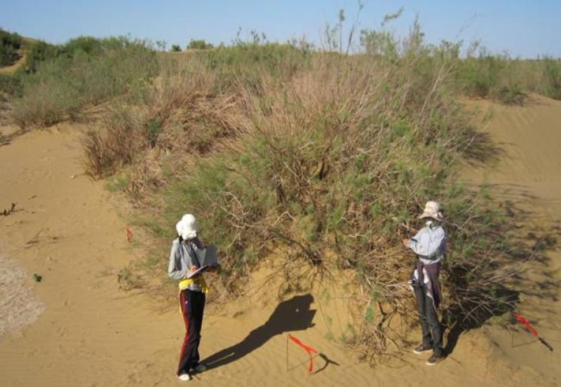
The annual ecological investigation data of desert vegetation with different desert types in the Heihe River Basin (2012)

The year-end ecological investigation was conducted in the late September and early October when plants stopped growing.
There are 8 investigation and observation fields, they are: piedmont desert, piedmont Gobi, desert in the middle, Gobi in the middle reaches, desert in the middle reaches, downstream desert, downstream Gobi, and downstream desert, the size of each filed is 40m×40m.
Three large quadrats of 20m×20m were selected in each observation field, named S1, S2, and S3, to conduce the regular shrub investigation; four small quadrats were selected from each large quadrat with a size of 5m×5m, named A, B, C, D, to conduct herbal investigation.
Data Citations
Related Literatures:1. Su, P. X. , Xie, T. T. , & Zhou, Z. J. . (2011). C4 plant species and geographical distribution in relation to climate in the desert vegetation of china. Sciences in Cold and Arid Regions, 003(5), 381-391.(View Details |Download )
Cite as:Su, P. (2014). < b>The annual ecological investigation data of desert vegetation with different desert types in the Heihe River Basin (2012)</b>2014. doi: 10.3972/heihe.217.2013.db. (Download the reference: RIS | Bibtex )
Using this data, the data citation is required to be referenced and the related literatures are suggested to be cited.
Terms of Use
To respect the intellectual property rights, protect the rights of data authors, expand services of the data center, and evaluate the application potential of data, data users should clearly indicate the source of the data and the author of the data in the research results generated by using the data (including published papers, articles, data products, and unpublished research reports, data products and other results). For re-posting (second or multiple releases) data, the author must also indicate the source of the original data.
Support Program
Water use efficiency and related regulation mechanisms of desert vegetation in different scales
Related Resources
1.The leaf water potential dataset in the downstream of the Heihe River Basin (2012)
2.HiWATER: the albedo in the middle reaches of the Heihe River Basin (Jun. 29, 2012)
3.Grassland interception dataset of Tianlaochi watershed in Qilian Mountain
4.HiWATER: Dataset of infrared temperature in Zhanye Airport desert
7.HiWATER: Airborne CCD image data in Hulugou Catchment
9.Leaf area index of Qinhai spruce stand at 2800 m above sea level in Pailougou watershed (2011)
No record
No record
Comments
Sign In to add comments
Keywords
Geographic coverage
| Spatial coverage |
East:101.28305555 South:38.70694444 |
West:99.752777777 North:42.1147222222222 |
|---|
Details
- Format: EXCEL
- File size: 0.2 MB
- Browse count:7816
- Temporal coverage:2018-11-23 To 2018-11-23
- Access: Offline
- Updated time:2021-04-19
Authors
Resource Provider: SU Peixi

 Copyright ©right; 2017 - 中国科学院西北生态环境资源研究院 - 兰州数云软件科技有限公司提供技术支持