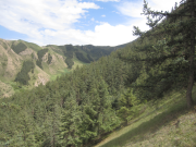
Forest investigation data about Qinghai spruce stand in Pailougou watershed (2011)

Forest survey is the application of measurement, tree measurement, remote sensing and other professional techniques and methods, survey, sampling and computer technology and other means to understand the quantity, quality, distribution and growth of forests within a specific range, so as to provide basic data for the formulation of forestry policies and scientific management of forests, as well as for scientific research. In the drainage ditch watershed of Qilian Mountain, there are three plots of Picea crassifolia forest in Qinghai Province, each of which is 2800m, 2900m and 3000m above sea level. Plot 01 is 20 * 30m and plot 02-09 is 20 * 35m. The traditional methods were used to investigate the tree height, DBH, base diameter and crown diameter of Picea crassifolia, providing basic data for the study of ecological hydrology of Picea crassifolia forest in the upper reaches of Heihe River.
Copyright & License
Excel format storage
Data Citations
Cite as:Chang, X. (2014). < b>Forest investigation data about Qinghai spruce stand in Pailougou watershed (2011)</b>2014. doi: 10.3972/heihe.007.2014.db. (Download the reference: RIS | Bibtex )
Using this data, the data citation is required to be referenced and the related literatures are suggested to be cited.
Terms of Use
To respect the intellectual property rights, protect the rights of data authors, expand services of the data center, and evaluate the application potential of data, data users should clearly indicate the source of the data and the author of the data in the research results generated by using the data (including published papers, articles, data products, and unpublished research reports, data products and other results). For re-posting (second or multiple releases) data, the author must also indicate the source of the original data.
Support Program
None
Related Resources
1.Leaf area index of Qinhai spruce stand at 2800 m above sea level in Pailougou watershed (2011)
3.Ground water level dataset in Hulugou sub-basin of Heihe River Basin (2011)
5.The data of desert plants photosynthetic organ traits (2011)
6.The data of canopy photosynthesis measurements of desert plants (2013)
7.Physiological index analysis data of typical desert plants in Heihe River basin (2011-2012)
No record
No record
Comments
Sign In to add comments
Keywords
- Discipline: Ecology Biogeography
- Theme: tree height Picea crassifolia forest
- Places:
- Time: 2011
Geographic coverage
| Spatial coverage |
East:100.307 South:38.529 |
West:100.286 North:38.558 |
|---|
Details
- Format: EXCEL
- File size: 2.2 MB
- Browse count:7743
- Temporal coverage:2018-11-22 To 2018-11-22
- Access: Offline
- Updated time:2021-04-18
Authors
Resource Provider: CHANG Xuexiang

 Copyright ©right; 2017 - 中国科学院西北生态环境资源研究院 - 兰州数云软件科技有限公司提供技术支持