Dataset of physilogical ecology for dominants in the Heihe River Basin (2013)

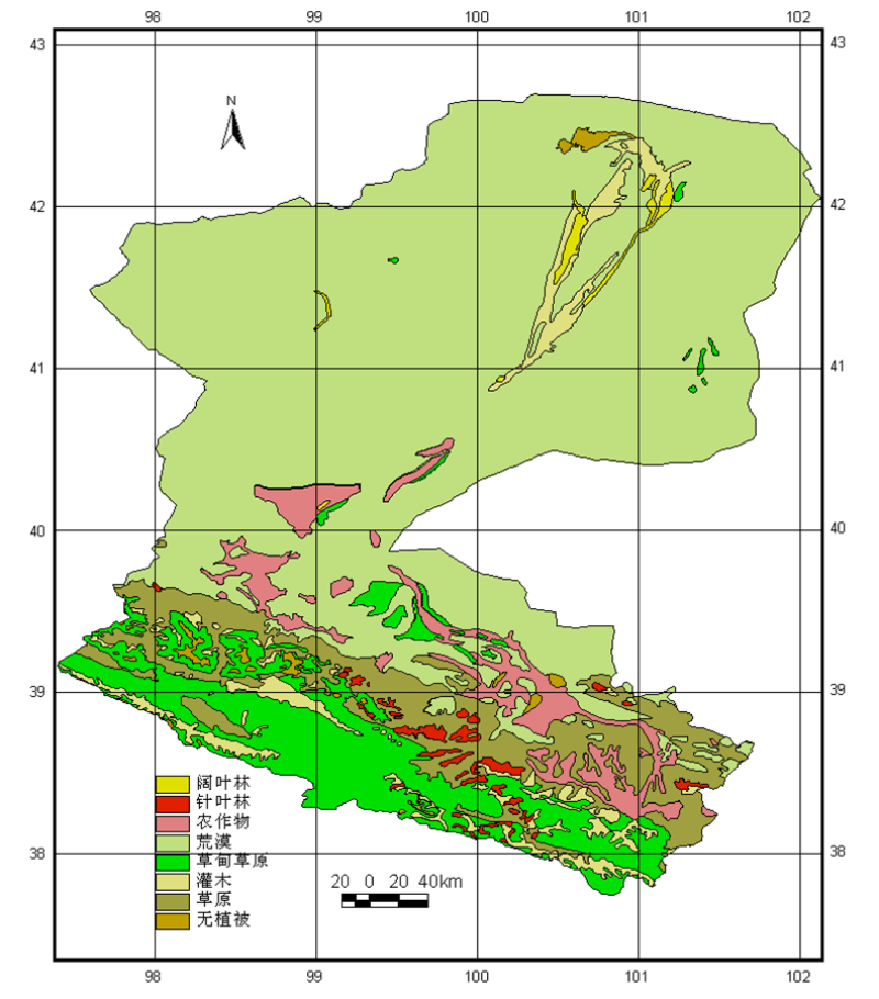
The data set is the physiological and ecological parameters of the dominant species of each ecosystem in Heihe River Basin. According to the requirements of tesim model, the data set divides Heihe River basin into seven ecosystems: deciduous broad-leaved forest ecosystem (BRD), evergreen coniferous forest ecosystem (CNF), agricultural field ecosystem (CRP), desert ecosystem (DST), meadow grassland ecosystem (MDS) Shrubbery ecosystem (SHB) and grassland ecosystem (STP). Some of the data in this data set are based on the measured data, some are obtained by reference documents, but after verification, they are applied to the Heihe River Basin. For the data in this data, each parameter of each ecosystem has three values, which are the value in the model, the minimum value and the maximum value of this parameter.
The data can provide input parameters for the ecological process model, and the data set is still in further optimization.
Copyright & License
. xlsx format storage
Data Citations
Cite as:Peng, H. (2014). < b>Dataset of physilogical ecology for dominants in the Heihe River Basin (2013)</b>2014. doi: 10.3972/heihe.053.2014.db. (Download the reference: RIS | Bibtex )
Using this data, the data citation is required to be referenced and the related literatures are suggested to be cited.
Terms of Use
To respect the intellectual property rights, protect the rights of data authors, expand services of the data center, and evaluate the application potential of data, data users should clearly indicate the source of the data and the author of the data in the research results generated by using the data (including published papers, articles, data products, and unpublished research reports, data products and other results). For re-posting (second or multiple releases) data, the author must also indicate the source of the original data.
Support Program
None
Related Resources
1.Physical and chemical index data of deep drilling strata in the middle reaches of Heihe River (2013)
2.The leaf water potential dataset in the downstream of the Heihe River Basin (2012)
3.Grassland interception dataset of Tianlaochi watershed in Qilian Mountain
6.The boundary of Heihe River Basin (1985)
7.A survey construction of a water-saving society in Zhangye city, Gansu (2013)
8.The soil heat flux dataset in the lower reaches of Heihe River (2011-2013)
9.The monitoring data of the groundwater level in the middle of Heihe River basin (2005-2007)
No record
No record
Comments
Sign In to add comments
Keywords
Geographic coverage
| Spatial coverage |
East:102.0 South:37.68 |
West:96.7 North:42.7 |
|---|
Details
- Format: EXCEL
- File size: 0.02 MB
- Browse count:10798
- Temporal coverage:2018-11-22 To 2018-11-22
- Access: Offline
- Updated time:2021-04-19
Authors
Resource Provider: PENG Hongchun

 Copyright ©right; 2017 - 中国科学院西北生态环境资源研究院 - 兰州数云软件科技有限公司提供技术支持