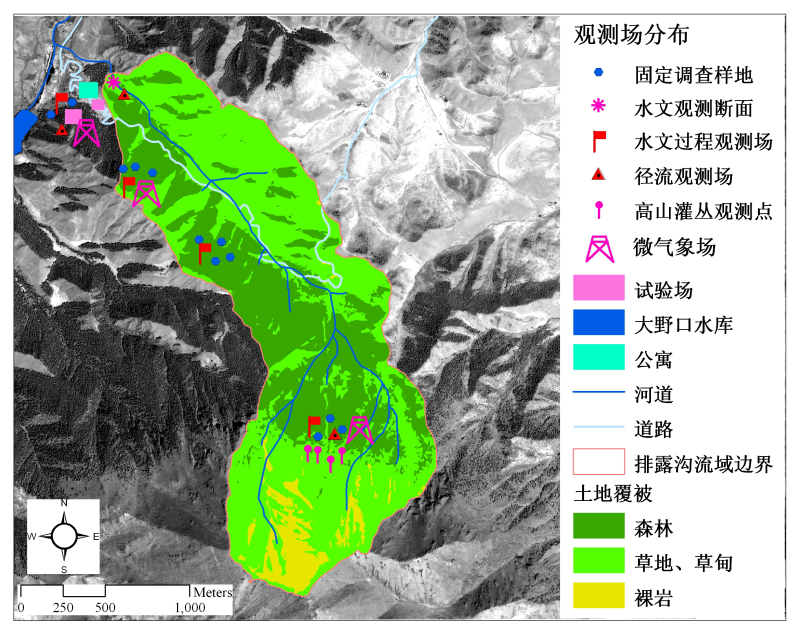
Export runoff records of Pailugou basin (2013)

The content is the daily runoff observation record of the outlet weir of the Pailugou basin. The spatial range of Pailugou: 38.529-38.558N, 100.286-100.536E. Data dates include May 1, 2013 to September 5, 2013. The unit is m3/day.
Data Citations
Cite as:He, Z. (2014). < b>Export runoff records of Pailugou basin (2013)</b>2014. doi: 10.3972/heihe.079.2014.db. (Download the reference: RIS | Bibtex )
Using this data, the data citation is required to be referenced and the related literatures are suggested to be cited.
Terms of Use
To respect the intellectual property rights, protect the rights of data authors, expand services of the data center, and evaluate the application potential of data, data users should clearly indicate the source of the data and the author of the data in the research results generated by using the data (including published papers, articles, data products, and unpublished research reports, data products and other results). For re-posting (second or multiple releases) data, the author must also indicate the source of the original data.
Support Program
The runoff process observation and simulation in typical small watershed of upperstream of Heihe river
Related Resources
2.Physical and chemical index data of deep drilling strata in the middle reaches of Heihe River (2013)
3.The leaf water potential dataset in the downstream of the Heihe River Basin (2012)
4.Grassland interception dataset of Tianlaochi watershed in Qilian Mountain
5.Datasets for the SWAT model in Heihe Rriver Basin
6.Thematic analysis data of Murray Darling basin Research in Australia (1912-2012)
8.The boundary of Heihe River Basin (1985)
9.10 m meteorological gradient data set of hulugou basin (2012)
10.A survey construction of a water-saving society in Zhangye city, Gansu (2013)
No record
No record
Comments
Sign In to add comments

 Copyright ©right; 2017 - 中国科学院西北生态环境资源研究院 - 兰州数云软件科技有限公司提供技术支持