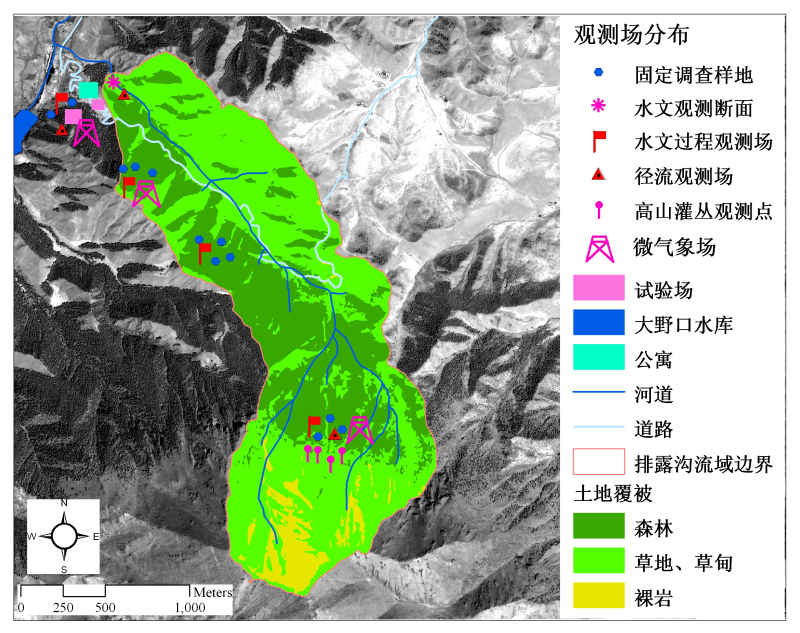
The micro-meterological data at 3200m high altitude in Pailougou watershed

The meteorological field is located at 3200m above sea level in Pailugou watershed of Qilian Mountain, which belongs to the high mountain forest line zone, the ecotone of Picea crassifolia forest and alpine shrub. This data set includes precipitation, air temperature, radiation, wind speed, etc., with units are mm, ℃, W/m^2 and m/s respectively. The date of data recording is from June 2012 to October 2013, in which the temperature data is partially missing due to the instrument.
Data Citations
Cite as:He, Z. (2014). < b>The micro-meterological data at 3200m high altitude in Pailougou watershed</b>2014. doi: 10.3972/heihe.073.2014.db. (Download the reference: RIS | Bibtex )
Using this data, the data citation is required to be referenced and the related literatures are suggested to be cited.
Terms of Use
To respect the intellectual property rights, protect the rights of data authors, expand services of the data center, and evaluate the application potential of data, data users should clearly indicate the source of the data and the author of the data in the research results generated by using the data (including published papers, articles, data products, and unpublished research reports, data products and other results). For re-posting (second or multiple releases) data, the author must also indicate the source of the original data.
Support Program
The runoff process observation and simulation in typical small watershed of upperstream of Heihe river
Related Resources
Comments
Sign In to add comments
Keywords
Geographic coverage
| Spatial coverage |
East:100.308 South:38.529 |
West:100.286 North:38.556 |
|---|
Details
- Temporal resolution: Yearly
- Spatial resolution: 10m - 100m
- Format: EXCEL
- File size: 0.035 MB
- Browse count:7948
- Temporal coverage:2012-06-10 To 2013-11-09
- Access: Offline
- Updated time:2021-04-20
Authors
Resource Provider: HE Zhibin

 Copyright ©right; 2017 - 中国科学院西北生态环境资源研究院 - 兰州数云软件科技有限公司提供技术支持