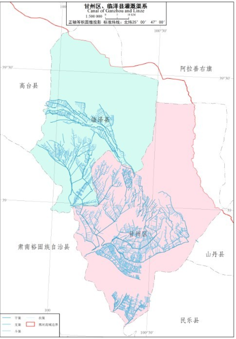
The gannal distribution of Zhangye,Linze and Gaotai

"Heihe River Basin Ecological hydrological comprehensive atlas" is supported by the key project of Heihe River Basin Ecological hydrological process integration research. It aims at data arrangement and service of Heihe River Basin Ecological hydrological process integration research. The atlas will provide researchers with a comprehensive and detailed background introduction and basic data set of Heihe River Basin.
The scale of Zhangye irrigation canal system map in Heihe River Basin is 1:2500000, the normal axis is equal to the conic projection, and the standard latitude is 2547 n.
Data sources: Zhangye irrigation canal system data of Heihe River Basin, administrative boundary data of one million Heihe River Basin in 2008, and Heihe River Basin in 2009.
The channels of Heihe River Basin are mainly distributed in Zhangye, which are divided into five levels: dry, branch, Dou, Nong and Mao.
Copyright & License
. JPG format storage
Data Citations
Cite as:Wang, J., Zhao, J., Wang, X., Feng, B. (2015). < b>The gannal distribution of Zhangye,Linze and Gaotai</b>2015. doi: 10.3972/heihe.0064.2013.db. (Download the reference: RIS | Bibtex )
Using this data, the data citation is required to be referenced and the related literatures are suggested to be cited.
Terms of Use
To respect the intellectual property rights, protect the rights of data authors, expand services of the data center, and evaluate the application potential of data, data users should clearly indicate the source of the data and the author of the data in the research results generated by using the data (including published papers, articles, data products, and unpublished research reports, data products and other results). For re-posting (second or multiple releases) data, the author must also indicate the source of the original data.
Related Resources
1.Scenario analysis of social and economic development over Heihe River Basin (2020 & 2030)
2.Physical and chemical index data of deep drilling strata in the middle reaches of Heihe River (2013)
3.The leaf water potential dataset in the downstream of the Heihe River Basin (2012)
4.Datasets for the SWAT model in Heihe Rriver Basin
5.The boundary of Heihe River Basin (1985)
6.A survey construction of a water-saving society in Zhangye city, Gansu (2013)
7.The soil heat flux dataset in the lower reaches of Heihe River (2011-2013)
8.The monitoring data of the groundwater level in the middle of Heihe River basin (2005-2007)
9.Input output table of Heihe River Basin in Gansu Province in 2002 and 2007
No record
No record
Comments
Sign In to add comments
Keywords
Geographic coverage
| Spatial coverage |
East:104.2 South:37.7 |
West:96.1 North:43.3 |
|---|
Details
- Format: TIFF
- File size: 3.34 MB
- Browse count:12044
- Temporal coverage:2018-11-26 To 2018-11-26
- Access: Offline
- Updated time:2021-04-19
Authors
Resource Provider: WANG Jianhua ZHAO Jun WANG Xiaomin FENG Bin

 Copyright ©right; 2017 - 中国科学院西北生态环境资源研究院 - 兰州数云软件科技有限公司提供技术支持