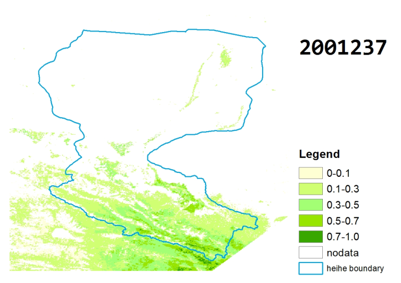
黑河流域时空连续FPAR数据集(2001-2011)

基于MODIS的FPAR(Fraction of Absorbed Photosynthetically Active Radiation)产品(MCD15A2和MOD15A2)利用改进的HANTS算法去云重建得到了2001-2011每天黑河流域FPAR数据集。产品坐标系统为经纬度投影,空间范围为:96.5E-102.5E, 37.5N-43N。每天的数据存储为一个GEOTIFF文件,命名方式:heihe_yyyy_FPAR_recon.ddd.tif,其中yyyy是年份,ddd表示特定年份中的某一天。每年默认有365天的输出数据。数据类型为单精度浮点型,无效值像元填充值为255,有效的数据范围为0-100,缩放因子为0.01。
Data Citations
Related Literatures:1. Jia, L., Shang, H., Hu, G., Menenti, M. (2011). Phenological response of vegetation to upstream river flow in the Heihe Rive basin by time series analysis of MODIS data. Hydrology and Earth System Sciences, 15(3), 1047-1064, doi:10.5194/hess-15-1047-2011.(View Details)
Cite as:Jia, L. (2014). < b>The cloud-free FPAR data in the Heihe River Basin (2001-2011)</b>2014. doi: 10.3972/heihe.113.2013.db. (Download the reference: RIS | Bibtex )
Using this data, the data citation is required to be referenced and the related literatures are suggested to be cited.
References literature
1.Zhou, J, Jia, L., Hu, G.C., Menenti, M. (2012). Evaluation of Harmonic Analysis of Time Series (HANTS): impact of gaps on time series reconstruction. In: The Second International Workshop on Earth Observation and Remote Sensing Applications (EORSA 2012), Shanghai, China, 8-11 June 2012, pp.31-35, doi: 10.1109/EORSA.2012.6261129. (View Details )
Terms of Use
为尊重知识产权、保障数据作者的权益、扩展数据中心的服务、评估数据的应用潜力,请数据使用者在使用数据所产生的研究成果中(包括公开发表的论文、论著、数据产品和未公开发表的研究报告、数据产品等成果),明确注明数据来源和数据作者。对于转载(二次或多次发布)的数据,作者还须注明原始数据来源。
Support Program
None
Related Resources
1.The leaf water potential dataset in the downstream of the Heihe River Basin (2012)
2.Grassland interception dataset of Tianlaochi watershed in Qilian Mountain
4.The boundary of Heihe River Basin (1985)
5.The soil heat flux dataset in the lower reaches of Heihe River (2011-2013)
6.The monitoring data of the groundwater level in the middle of Heihe River basin (2005-2007)
8.The boundary of the Heihe River Basin in 2010
No record
No record
Comments
Sign In to add comments
Keywords
- Discipline: Physical Geography
- Theme: fraction of absorbed photosynthetically active radiation vegetation plants Moderate Resolution Imaging Spectrometer
- Places:
- Time: 2000-2011
Geographic coverage
| Spatial coverage |
East:102.5 South:37.5 |
West:96.5 North:43.0 |
|---|
Details
- Format: 栅格
- File size: 4780.0 MB
- Browse count:7164
- Temporal coverage:2001-01-12 To 2012-01-07
- Access: Offline
- Updated time:2021-04-18
Authors
Resource Provider: JIA Li

 Copyright ©right; 2017 - 中国科学院西北生态环境资源研究院 - 兰州数云软件科技有限公司提供技术支持