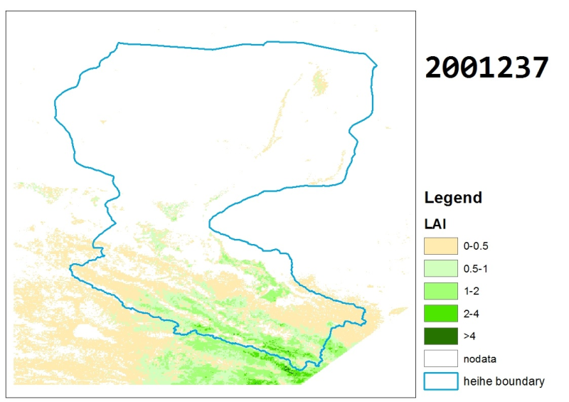
The cloud-free LAI dataset in the Heihe River Basin (2001-2011)

Based on MODIS Lai products (mcd15a2 and mod15a2), the daily and 1km resolution Lai datasets of 2001-2011 are obtained by using the improved hats algorithm to remove the cloud and reconstruct. The product coordinate system is longitude and latitude projection, and the spatial range is 96.5e-102.5e, 37.5n-43n. Every day's data is stored as a geotif file. The name is Heihe YYY ɇ Lai ɇ recon.ddd.tif, where yyyy is the year and DDD represents a certain day in a specific year. There are 365 days of output data by default every year. The data type is single precision floating-point type, the pixel filling value of invalid value is 255, the valid data range is 0-100, and the scaling factor is 0.1.
Data Citations
Related Literatures:1. Jia, L., Shang, H., Hu, G., Menenti, M. (2011). Phenological response of vegetation to upstream river flow in the Heihe Rive basin by time series analysis of MODIS data. Hydrology and Earth System Sciences, 15(3), 1047-1064, doi:10.5194/hess-15-1047-2011.(View Details)
Cite as:Jia, L. (2014). < b>The cloud-free LAI dataset in the Heihe River Basin (2001-2011)</b>2014. doi: 10.3972/heihe.111.2013.db. (Download the reference: RIS | Bibtex )
Using this data, the data citation is required to be referenced and the related literatures are suggested to be cited.
References literature
1.Zhou, J, Jia, L., Hu, G.C., Menenti, M. (2012). Evaluation of Harmonic Analysis of Time Series (HANTS): impact of gaps on time series reconstruction. In: The Second International Workshop on Earth Observation and Remote Sensing Applications (EORSA 2012), Shanghai, China, 8-11 June 2012, pp.31-35, doi: 10.1109/EORSA.2012.6261129. (View Details )
Terms of Use
To respect the intellectual property rights, protect the rights of data authors, expand services of the data center, and evaluate the application potential of data, data users should clearly indicate the source of the data and the author of the data in the research results generated by using the data (including published papers, articles, data products, and unpublished research reports, data products and other results). For re-posting (second or multiple releases) data, the author must also indicate the source of the original data.
Support Program
None
Related Resources
1.HiWATER: the albedo in the middle reaches of the Heihe River Basin (Jun. 29, 2012)
2.HiWATER: Dataset of infrared temperature in Zhanye Airport desert
4.Leaf area index of Qinhai spruce stand at 2800 m above sea level in Pailougou watershed (2011)
5.HiWATER: Dataset of emissivity of typical terrain over Heihe River Basin (2014.03.25-2015.06.30)
6.HiWATER: Airborne LiDAR raw data in Hulugou catchment
8.HiWATER: Dataset of the spectral reflectance in the middle of Heihe River Basin
No record
No record
Comments
Sign In to add comments
Keywords
- Discipline: remote sensing products
- Theme: LAI leaf area index Moderate Resolution Imaging Spectrometer
- Places:
- Time: 2000-2011
Geographic coverage
| Spatial coverage |
East:102.5 South:37.5 |
West:96.5 North:43.0 |
|---|
Details
- Format: 栅格
- File size: 4940.0 MB
- Browse count:7831
- Temporal coverage:2001-01-10 To 2012-01-09
- Access: Offline
- Updated time:2021-04-17
Authors
Resource Provider: JIA Li

 Copyright ©right; 2017 - 中国科学院西北生态环境资源研究院 - 兰州数云软件科技有限公司提供技术支持