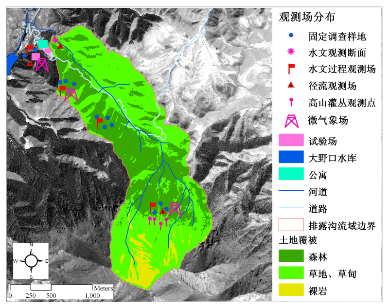
Soil moisture content in Pailougou watershed (2012-2013)

The data of soil moisture in the Pailougou include the grassland on the shady slope of 2700m above sea level and the Picea crassifolia forest of 2800m above sea level. The soil water content monitoring system EM50 was used to measure the water content in five soil layers, 10cm, 20cm, 30cm, 40cm and 60cm respectively. The in-forest survey period is from June 2012 to September 2012, and there are also data for June 2013. The meadows were measured from June 2013 to October 2013. The measurement results are all volume water content in%.
Data Citations
Cite as:He, Z. (2014). < b>Soil moisture content in Pailougou watershed (2012-2013)</b>2014. doi: 10.3972/heihe.226.2013.db. (Download the reference: RIS | Bibtex )
Using this data, the data citation is required to be referenced and the related literatures are suggested to be cited.
Terms of Use
To respect the intellectual property rights, protect the rights of data authors, expand services of the data center, and evaluate the application potential of data, data users should clearly indicate the source of the data and the author of the data in the research results generated by using the data (including published papers, articles, data products, and unpublished research reports, data products and other results). For re-posting (second or multiple releases) data, the author must also indicate the source of the original data.
Support Program
The runoff process observation and simulation in typical small watershed of upperstream of Heihe river
Related Resources
1.The leaf water potential dataset in the downstream of the Heihe River Basin (2012)
2.HiWATER: Dataset of infrared temperature in Zhanye Airport desert
4.The boundary of Heihe River Basin (1985)
6.10 m meteorological gradient data set of hulugou basin (2012)
8.The soil heat flux dataset in the lower reaches of Heihe River (2011-2013)
9.The monitoring data of the groundwater level in the middle of Heihe River basin (2005-2007)
No record
No record
Comments
Sign In to add comments

 Copyright ©right; 2017 - 中国科学院西北生态环境资源研究院 - 兰州数云软件科技有限公司提供技术支持