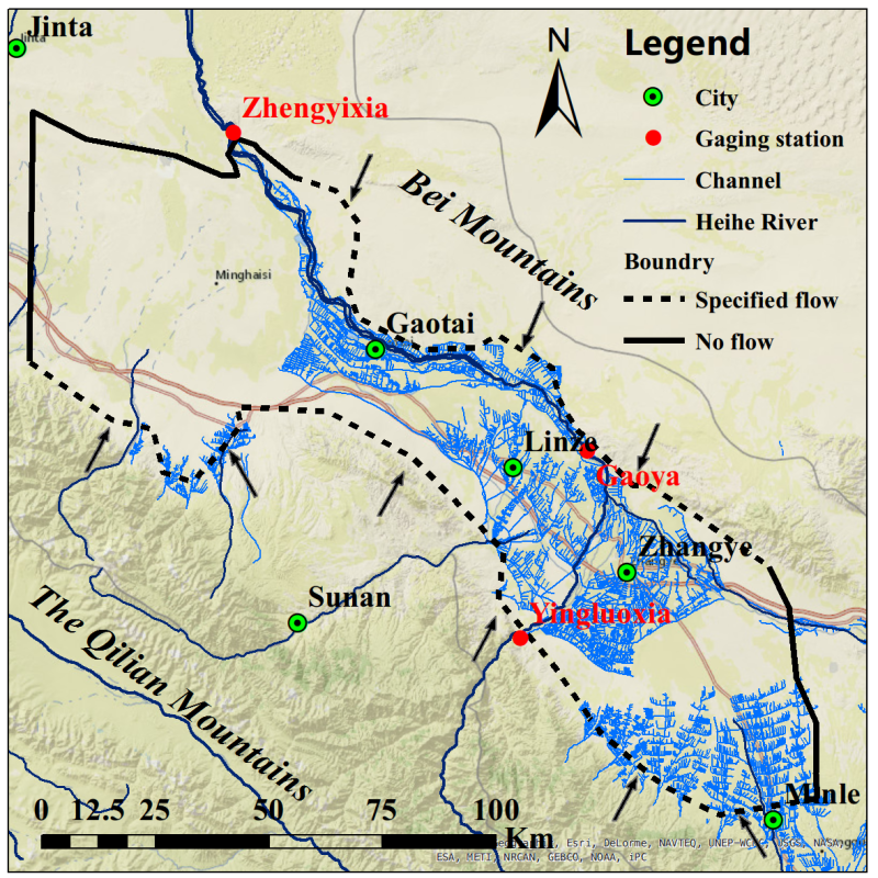
Data set of simulation results of key hydrological variables in Zhangye basin of Heihe River Basin (1990-2012)

This project is based on the gsflow model of USGS to simulate the surface groundwater coupling in Zhangye basin in the middle reaches of Heihe River. The space-time range and accuracy of the simulation are as follows:
Simulation period: 1990-2012;
Simulation step: day by day;
The spatial scope of simulation: Zhangye basin;
The spatial accuracy of simulation: the underground part is 1km × 1km grid (5 layers, the total number of grids in each layer is 150 × 172 = 25800, among which the active grid 9106); the surface part is based on the hydrological response unit (HRU) (588 in total, each HRU covers an area of several square kilometers to dozens of square kilometers).
The data include: surface infiltration, actual evapotranspiration, average soil moisture content, surface groundwater exchange, shallow groundwater level, simulated daily flow of Zhengyi gorge, simulated monthly flow of Zhengyi gorge, groundwater extraction and river diversion
Copyright & License
. SHP format storage
Data Citations
Related Literatures:1. Wu, B., Zheng, Y.*, Tian, Y., Wu, X., Yao, Y., Han, F., Liu, J., Zheng, C. (2014). Systematic assessment of the uncertainty in integrated surface water-groundwater modeling based on the probabilistic collocation method, Water Resources Research., 50, 5848–5865, doi:10.1002/2014WR015366.(View Details)
Cite as:Zheng, Y. (2015). < b>Data set of simulation results of key hydrological variables in Zhangye basin of Heihe River Basin (1990-2012)</b>2015. doi: 10.3972/heihe.070.2014.db. (Download the reference: RIS | Bibtex )
Using this data, the data citation is required to be referenced and the related literatures are suggested to be cited.
Terms of Use
To respect the intellectual property rights, protect the rights of data authors, expand services of the data center, and evaluate the application potential of data, data users should clearly indicate the source of the data and the author of the data in the research results generated by using the data (including published papers, articles, data products, and unpublished research reports, data products and other results). For re-posting (second or multiple releases) data, the author must also indicate the source of the original data.
Support Program
None
Related Resources
2.The leaf water potential dataset in the downstream of the Heihe River Basin (2012)
3.Grassland interception dataset of Tianlaochi watershed in Qilian Mountain
4.Datasets for the SWAT model in Heihe Rriver Basin
5.HiWATER: Dataset of infrared temperature in Zhanye Airport desert
6.Thematic analysis data of Murray Darling basin Research in Australia (1912-2012)
10.10 m meteorological gradient data set of hulugou basin (2012)
No record
No record
Comments
Sign In to add comments

 Copyright ©right; 2017 - 中国科学院西北生态环境资源研究院 - 兰州数云软件科技有限公司提供技术支持