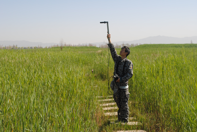
HiWATER: Dataset of vegetation LAI measured by LAI2000 in the middle reaches of the Heihe River Basin

This dataset is the LAI observation in the artificial oasis experimental region of the middle stream of the Heihe River Basin. The observation period is from 24 May to 20 September 2012 (UTC+8).
Measurement instruments:
LAI-2000 (Beijing Normal University)
Measurement positions:
Core Experimental Area of Flux Observation Matrix
18 corn samples, 1 orchard sample, 1 artificial white poplar sample
Measurement methods:
To measure the incoming sky radiation on the canopy firstly. Then the transmission sky radiation are mearued under the canopy for serveral times. The canopy LAI is retrieved by using the gap probability model.
Data Citations
Related Literatures:1. Li, X., Liu, S.M., Xiao, Q., Ma, M.G., Jin, R., Che, T., Wang, W.Z., Hu, X.L., Xu, Z.W., Wen, J.G., Wang, L.X. (2017). A multiscale dataset for understanding complex eco-hydrological processes in a heterogeneous oasis system. Scientific Data, 4, 170083. doi:10.1038/sdata.2017.83.(View Details |Download )
Cite as:Ma, M. (2017). < b>HiWATER: Dataset of vegetation LAI measured by LAI2000 in the middle reaches of the Heihe River Basin</b>2017. doi: 10.3972/hiwater.058.2013.db. (Download the reference: RIS | Bibtex )
Using this data, the data citation is required to be referenced and the related literatures are suggested to be cited.
References literature
1.Li Xin, Liu Shaomin, Ma Mingguo, Xiao Qing, Liu Qinhuo, Jin Rui, Che Tao. HiWATER: An Integrated Remote Sensing Experiment on Hydrological and Ecological Processes in the Heihe River Basin. Advances in Earth Science, 2012, 27(5): 481-498. (View Details |Download)
2.Li X, Cheng GD, Liu SM, Xiao Q, Ma MG, Jin R, Che T, Liu QH, Wang WZ, Qi Y, Wen JG, Li HY, Zhu GF, Guo JW, Ran YH, Wang SG, Zhu ZL, Zhou J, Hu XL, Xu ZW. Heihe Watershed Allied Telemetry Experimental Research (HiWATER): Scientific objectives and experimental design. Bulletin of the American Meteorological Society, 2013, 94(8): 1145-1160, 10.1175/BAMS-D-12-00154.1. (View Details )
Terms of Use
To respect the intellectual property rights, protect the rights of data authors, expand services of the data center, and evaluate the application potential of data, data users should clearly indicate the source of the data and the author of the data in the research results generated by using the data (including published papers, articles, data products, and unpublished research reports, data products and other results). For re-posting (second or multiple releases) data, the author must also indicate the source of the original data.
Support Program
Heihe Watershed Allied Telemetry Experimental Research (HiWATER)
Related Resources
1.The leaf water potential dataset in the downstream of the Heihe River Basin (2012)
2.HiWATER: the albedo in the middle reaches of the Heihe River Basin (Jun. 29, 2012)
3.Grassland interception dataset of Tianlaochi watershed in Qilian Mountain
4.HiWATER: Dataset of infrared temperature in Zhanye Airport desert
No record
No record
Comments
Sign In to add comments
Keywords
- Discipline: 陆地表层
- Theme: 叶面积指数 植被
- Places:
- Time: 2012-07-07 2012-06-09 2012-06-28 2012 2012-06-23 2012-05-30 2012-06-01 2012-06-02 2012-05-28 2012-06-08 2012-05-24 2012-06-11 2012-07-03 2012-05-29 2012-06-03
Geographic coverage
| Spatial coverage |
East:100.46 South:38.734 |
West:100.289 North:38.88 |
|---|
Details
- Format: 文本
- File size: 0.14 MB
- Browse count:19693
- Temporal coverage:2012-06-06 To 2012-07-20
- Access: Offline
- Updated time:2021-04-19
Authors
Data Service: Zhao Jing Xie Donghui
Principal Investigator: Li Yun Wang Yan
Resource Provider: MA Mingguo

 Copyright ©right; 2017 - 中国科学院西北生态环境资源研究院 - 兰州数云软件科技有限公司提供技术支持