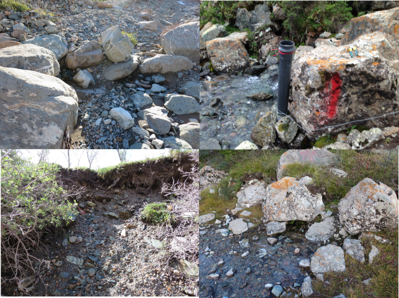
Spring discharge observations of Hulugou small watershed in Heihe Rivers basin (July 2012)

一. data description
The data included the spring flow observation data of 5 springs in the small gully basin in July 2012.
二. Sampling location
The sampling point of quan 1 is xizhigou daquan, with the latitude and longitude of 99 ° 51 '23 "E, 38 ° 14' 33" N.
The sampling point of spring 2 is 20 meters east of the outlet of the basin, with the latitude and longitude of 99°52 '50.9 "E,38°16' 11.44" N.
The sampling point of spring 3 is 80 meters east of the outlet of the basin, with the latitude and longitude of 99°52 '52.8 "E,38°16' 11.24" N.
The sampling point of spring 4 is 120 meters east of the outlet of the basin, with the latitude and longitude of 99°52 '55.9 "E,38°16' 11.4" N.
The sampling point of quan 5 is 150 meters east of the outlet of the basin, with the latitude and longitude of 99°52 '55.9 "E,38°16' 11.5" N.
三. Test method
By estimating the velocity of the spring and the cross-sectional area of the spring to estimate the size of the spring flow.
Copyright & License
File name: the data is stored in the form of XLS, and the file is named as "XLS of the monitoring data of typical quanquan flow in the cucurbit valley from July to December 2012".</p><p>Data reading: Office, Wps and other Office software can be opened to read.
Data Citations
Cite as:Sun, Z., Chang, Q. (2015). < b>Spring discharge observations of Hulugou small watershed in Heihe Rivers basin (July 2012)</b>2015. doi: 10.3972/heihe.002.2015.db. (Download the reference: RIS | Bibtex )
Using this data, the data citation is required to be referenced and the related literatures are suggested to be cited.
Terms of Use
To respect the intellectual property rights, protect the rights of data authors, expand services of the data center, and evaluate the application potential of data, data users should clearly indicate the source of the data and the author of the data in the research results generated by using the data (including published papers, articles, data products, and unpublished research reports, data products and other results). For re-posting (second or multiple releases) data, the author must also indicate the source of the original data.
Support Program
Exploring snowmelt runoff processes using isotopic and hydrochemical data in Heihe River headwater catchments
Related Resources
2.The leaf water potential dataset in the downstream of the Heihe River Basin (2012)
3.HiWATER: the albedo in the middle reaches of the Heihe River Basin (Jun. 29, 2012)
4.Grassland interception dataset of Tianlaochi watershed in Qilian Mountain
5.Datasets for the SWAT model in Heihe Rriver Basin
6.HiWATER: Dataset of infrared temperature in Zhanye Airport desert
7.Thematic analysis data of Murray Darling basin Research in Australia (1912-2012)
10.10 m meteorological gradient data set of hulugou basin (2012)
No record
No record
Comments
Sign In to add comments
Keywords
Geographic coverage
| Spatial coverage |
East:99.8821944 South:38.269861 |
West:99.85639 North:38.2425 |
|---|
Details
- Temporal resolution: Daily
- Format: EXCEL
- File size: 0.01 MB
- Browse count:10051
- Temporal coverage:2012-07-19 To 2012-07-23
- Access: Offline
- Updated time:2021-04-19
Authors
Resource Provider: SUN Ziyong CHANG Qixin

 Copyright ©right; 2017 - 中国科学院西北生态环境资源研究院 - 兰州数云软件科技有限公司提供技术支持