HiWATER: Dataset of the Portable Soil Respiration in the middle reaches of the Heihe River Basin (2012)

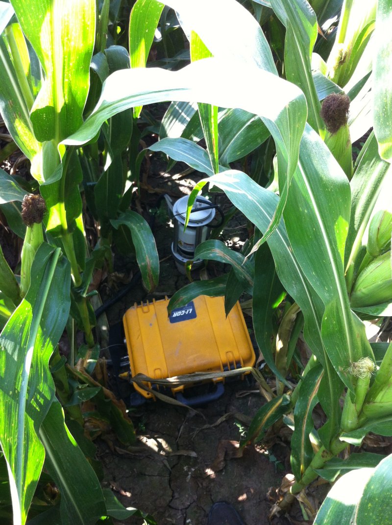
During the 2012 aerial remote sensing experiment conducted midstream, Li-Cor8100 was used to measure soil respiration every five days in the EC matrix area.
Instrument: LI-Cor8100
Measuring Method: Soil respiration ring was made using PVC pipe with length of 10 cm. Before measuring soil respiration, soil respiration ring was inserted into the soil, 4 cm in soil and 6 cm above soil. Soil respiration measurement should be taken after standing for at least 24 hours science ring was inserted in soil. Sample measurement time is during 9-12 in the morning. Set of three replicates per plot. Marked according to EC site name.
Data content: Data content includes header information, and once every five days repeated three times observations value and the average value.
Measuring location: EC sites within the matrix core experiment area (No. EC01 to EC17), each plot set three repeat samples. For the superstation (EC15) plot set nine repeat samples.
Measuring time: From 6 June to 20 August, 2012, once every five days for site EC01, EC03, EC05, EC10, EC11, EC12, EC13, EC14, and EC17; from 1 July to 20 August, 2012, once every five days for site EC02, EC04, EC06, EC07, EC08, EC09 and EC16. The time used in this dataset is in UTC+8 Time.
Part of the observation points during the observation just irrigation, these times are not observable.
Data Citations
Related Literatures:1. Li, X., Liu, S.M., Xiao, Q., Ma, M.G., Jin, R., Che, T., Wang, W.Z., Hu, X.L., Xu, Z.W., Wen, J.G., Wang, L.X. (2017). A multiscale dataset for understanding complex eco-hydrological processes in a heterogeneous oasis system. Scientific Data, 4, 170083. doi:10.1038/sdata.2017.83.(View Details |Download )
Cite as:Song, Y. (2017). < b>HiWATER: Dataset of the Portable Soil Respiration in the middle reaches of the Heihe River Basin (2012)</b>2017. doi: 10.3972/hiwater.034.2013.db. (Download the reference: RIS | Bibtex )
Using this data, the data citation is required to be referenced and the related literatures are suggested to be cited.
References literature
1.Li Xin, Liu Shaomin, Ma Mingguo, Xiao Qing, Liu Qinhuo, Jin Rui, Che Tao. HiWATER: An Integrated Remote Sensing Experiment on Hydrological and Ecological Processes in the Heihe River Basin. Advances in Earth Science, 2012, 27(5): 481-498. (View Details |Download)
2.Li X, Cheng GD, Liu SM, Xiao Q, Ma MG, Jin R, Che T, Liu QH, Wang WZ, Qi Y, Wen JG, Li HY, Zhu GF, Guo JW, Ran YH, Wang SG, Zhu ZL, Zhou J, Hu XL, Xu ZW. Heihe Watershed Allied Telemetry Experimental Research (HiWATER): Scientific objectives and experimental design. Bulletin of the American Meteorological Society, 2013, 94(8): 1145-1160, 10.1175/BAMS-D-12-00154.1. (View Details )
Terms of Use
To respect the intellectual property rights, protect the rights of data authors, expand services of the data center, and evaluate the application potential of data, data users should clearly indicate the source of the data and the author of the data in the research results generated by using the data (including published papers, articles, data products, and unpublished research reports, data products and other results). For re-posting (second or multiple releases) data, the author must also indicate the source of the original data.
Support Program
Heihe Watershed Allied Telemetry Experimental Research (HiWATER)
Related Resources
1.The leaf water potential dataset in the downstream of the Heihe River Basin (2012)
2.HiWATER: the albedo in the middle reaches of the Heihe River Basin (Jun. 29, 2012)
3.HiWATER: Dataset of infrared temperature in Zhanye Airport desert
7.HiWATER: Airborne CCD image data in Hulugou Catchment
10.The soil heat flux dataset in the lower reaches of Heihe River (2011-2013)
No record
No record
Comments
Sign In to add comments
Keywords
- Discipline: 陆地表层
- Theme: 土壤 土壤呼吸
- Places:
- Time: 2012 2012-06-06 to 2012-08-20
Geographic coverage
| Spatial coverage |
East:100.3983 South:38.8265 |
West:100.3364 North:38.8814 |
|---|
Details
- Format: 文本
- Browse count:12216
- Temporal coverage:2012-06-17 To 2012-08-31
- Access: Offline
- Updated time:2021-04-19

 Copyright ©right; 2017 - 中国科学院西北生态环境资源研究院 - 兰州数云软件科技有限公司提供技术支持