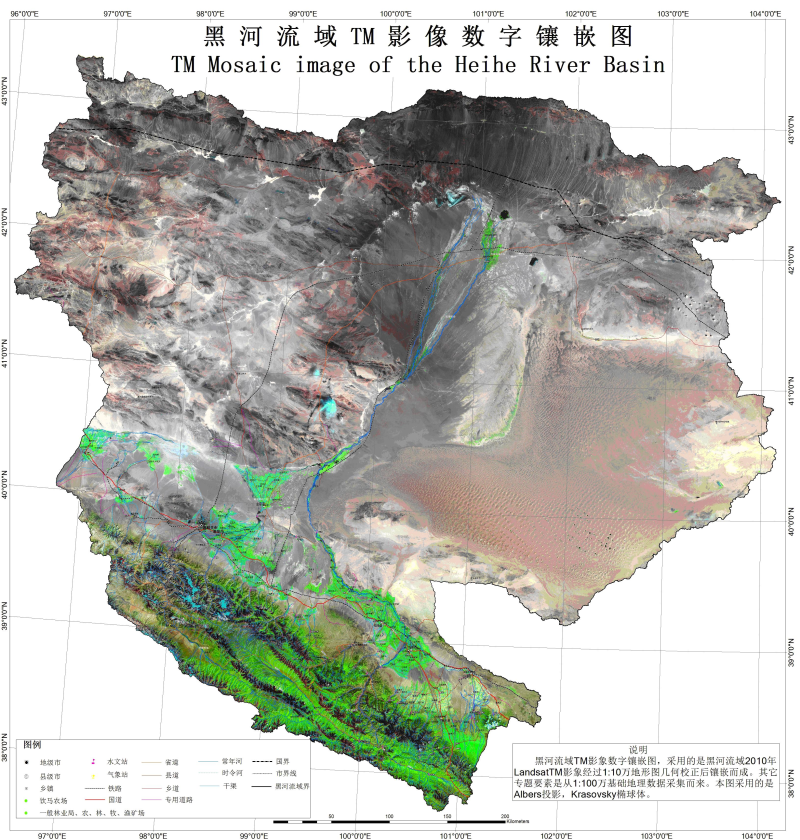
Landsat TM mosaic image of the Heihe River Basin (2010)

The Landsat TM Mosaic Image of the Heihe River Basin can be effectively applied to monitoring land-use change of the basin, which reflects the current situation of the Heihe River Basin in 2010, and provides a reliable basis for ecological planning and restoration.
This mosaic image collected the TM images released by the USGS for free in 2010 (data from July to September 2010, totally 21 scenes, the maximum cloud amount is less than 10%), and the preprocessed images were geometrically registered by topographic maps(polynomial geometry correction method), then a geometrically-corrected digital mosaic map was generated, which was of high quality after a certain accuracy evaluation.
The images were stored in ERDAS IMG format, and the most abundant bands 5, 4 and 3 combination, with three colors: red, green, and blue were selected to generate a color composite image. The combined composite image not only is similar to natural color, which is more in accordance with people's visual habits, but also can fully display the differences in image features because of the rich amount of information.
Data Citations
Cite as:LP DAAC User Services. (2013). < b>Landsat TM mosaic image of the Heihe River Basin (2010)</b>2013. (Download the reference: RIS | Bibtex )
Using this data, the data citation is required to be referenced and the related literatures are suggested to be cited.
Terms of Use
To respect the intellectual property rights, protect the rights of data authors, expand services of the data center, and evaluate the application potential of data, data users should clearly indicate the source of the data and the author of the data in the research results generated by using the data (including published papers, articles, data products, and unpublished research reports, data products and other results). For re-posting (second or multiple releases) data, the author must also indicate the source of the original data.
Support Program
Related Resources
1.HiWATER: the albedo in the middle reaches of the Heihe River Basin (Jun. 29, 2012)
2.Datasets for the SWAT model in Heihe Rriver Basin
3.HiWATER: Airborne CCD image data in Hulugou Catchment
6.HiWATER: Airborne CCD image data in the Shenshawo desert area of the Heihe River Basin
7.The boundary of the Heihe River Basin in 2010
No record
No record
Comments
Sign In to add comments
Keywords
Geographic coverage
| Spatial coverage |
East:104.25 South:37.65 |
West:96.05 North:43.3 |
|---|
Details
- Format: 栅格
- File size: 3281.3 MB
- Browse count:8915
- Temporal coverage:2010-07-07 To 2010-10-06
- Access: Offline
- Updated time:2021-04-20
Authors
Resource Provider: LP DAAC User Services

 Copyright ©right; 2017 - 中国科学院西北生态环境资源研究院 - 兰州数云软件科技有限公司提供技术支持