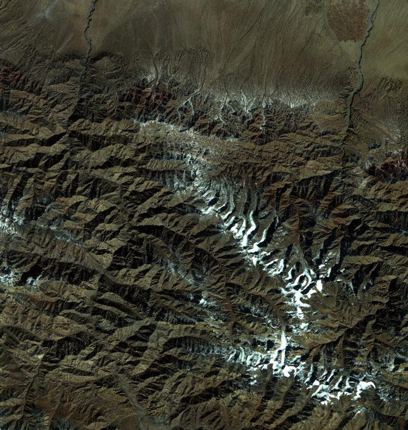
HiWATER: ZiYuan-3 (ZY-3) dataset

This dataset includes 44 scenes, covering the whole Heihe River Basin, which were acquired on (yy-mm-dd) 2012-08-25, 2012-09-03, 2012-09-08, 2012-09-13, 2012-09-18, 2012-09-23, 2012-09-28, 2012-10-03, 2012-10-13, 2012-10-18, 2012-10-22, 2012-11-01, 2012-11-11, 2012-11-21.
The data are of multi-spectral bands with data product of Level 1. The spatial resolution is 1 m.
ZY-3 dataset was acquired from purchase.
Data Citations
Cite as:China Centre for Resources Satellite Data and Application . (2013). < b>HiWATER: ZiYuan-3 (ZY-3) dataset</b>2013. (Download the reference: RIS | Bibtex )
Using this data, the data citation is required to be referenced and the related literatures are suggested to be cited.
References literature
1.Li Xin, Liu Shaomin, Ma Mingguo, Xiao Qing, Liu Qinhuo, Jin Rui, Che Tao. HiWATER: An Integrated Remote Sensing Experiment on Hydrological and Ecological Processes in the Heihe River Basin. Advances in Earth Science, 2012, 27(5): 481-498. (View Details |Download)
2.Li X, Cheng GD, Liu SM, Xiao Q, Ma MG, Jin R, Che T, Liu QH, Wang WZ, Qi Y, Wen JG, Li HY, Zhu GF, Guo JW, Ran YH, Wang SG, Zhu ZL, Zhou J, Hu XL, Xu ZW. Heihe Watershed Allied Telemetry Experimental Research (HiWATER): Scientific objectives and experimental design. Bulletin of the American Meteorological Society, 2013, 94(8): 1145-1160, 10.1175/BAMS-D-12-00154.1. (View Details )
Terms of Use
To respect the intellectual property rights, protect the rights of data authors, expand services of the data center, and evaluate the application potential of data, data users should clearly indicate the source of the data and the author of the data in the research results generated by using the data (including published papers, articles, data products, and unpublished research reports, data products and other results). For re-posting (second or multiple releases) data, the author must also indicate the source of the original data.
Support Program
"Heihe Watershed Allied Telemetry Experimental Research (HiWATER)
Related Resources
1.The leaf water potential dataset in the downstream of the Heihe River Basin (2012)
2.HiWATER: the albedo in the middle reaches of the Heihe River Basin (Jun. 29, 2012)
3.HiWATER: Dataset of infrared temperature in Zhanye Airport desert
6.HiWATER: Airborne CCD image data in Hulugou Catchment
10.HiWATER: Airborne CCD image data in the Shenshawo desert area of the Heihe River Basin
No record
No record
Comments
Sign In to add comments
Keywords
- Discipline: 陆地表层
- Theme: 多光谱影像 卫星影像 陆地表层遥感
- Places:
- Time: 2012-11-11 2012-09-13 2012-08-25 2012-09-03 2012-11-21 2012-09-28 2012 2012-10-13 2012-09-08 2012-10-03 2012-11-01 2012-09-23 2012-09-18 2012-10-18 2012-10-22
Geographic coverage
| Spatial coverage |
East:102.0 South:37.7 |
West:97.1 North:42.7 |
|---|
Details
- Format: 数字影像
- File size: 16486.4 MB
- Browse count:13037
- Temporal coverage:2012-09-03 To 2012-11-30
- Access: Offline
- Updated time:2021-04-19
Authors
Resource Provider: China Centre for Resources Satellite Data and Application

 Copyright ©right; 2017 - 中国科学院西北生态环境资源研究院 - 兰州数云软件科技有限公司提供技术支持